Example 6E: Maps of Properties on Extrema
Sometimes one wants to explore the distribution of property maxima or minima (collectively known as “extrema”) in a data file. Java OceanAtlas can locate and plot values of extrema. Of course multiple extrema can exist in one vertical profile, so JOA does not always return the expected result, but the results can nonetheless still be instructive.
Files that may be needed or created in this example:
WOA05_NorthAtlantic_square.joa
Exercise 6e-01
Continue from 6D-01:
To locate and plot the salinity minimum at each of the stations in the WOA05_NorthAtlantic.joa data file:
Calculations → Station Parameters → Extrema…
Set up (as shown below) for a calculation of the Min (minimum) in SALT (salinity) over each profile
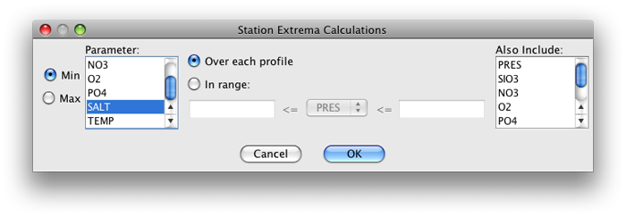
Fig 6e-01 Station Extrema Calculations dialog box
Click OK, the result will appear in the Data Window
With the open Orthographic Map Plot in the foreground, bring up the Configure Map Plot dialog box:
Double-click or control-click on a map plot
Or type [ctrl/cmd]-R or Edit → Edit: plotname when a map plot is the front-most window
Select the Station calculation values sub-panel of the Station Colors tab
A list of all available station calculations will be shown. Here we have just the Min of SALT calculation. Select it, and then select the SALT-global_cbr.xml color bar, as shown below
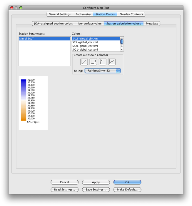
Fig 6e-02 Station Calculation Values sub-panel of Station Colors panel of the Configure Map Plot dialog box
Now when you click OK, you should see this plot:

Fig 6e-03 Orthographic plot
Examine
This is another interesting plot, though a bit tricky to interpret in places. Start by looking at the freshest (bluest) areas. Can you find the areas where the Mississippi, Amazon, and Congo rivers enter the oceans? See how the fresh Baltic Sea outflows are swept northward into the Arctic? See how the fresh Arctic outflows hug the eastern boundary of North America but also spread into the interior between Canada and Greenland and north of Iceland?